Elevate Transit Zoning for Accessibility is Here
Frequently Asked Questions
 1. What is the new text amendment?
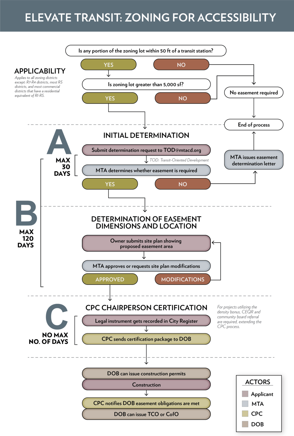
Under the Elevate Transit: Zoning for Accessibility text amendment, the MTA has the option to require a transit easement on most development sites in New York City that are at least 5,000 square feet and within 50 feet of a mass transit station. The text has wide applicability across the city and may affect development programming and site layout. The intent of the text amendment is to provide a location for future entrances to transit stations. The transit stations where an easement may be required are shown in our interactive map below.
In some central business districts, developments near transit stations may qualify for up to a 20% density bonus in exchange for completing transit improvements.
2. What do I do if my project is adjacent to an eligible transit station?
Begin the initial determination process with the MTA. The MTA then has 30 days to determine whether an easement is necessary. If an easement is determined necessary, the MTA must approve its location and volume within 120 days from the start of the initial determination process.
3. How will this affect development schedule – will it delay obtaining building permits?
The text amendment sets a 120-day limit for the MTA to determine if an easement is necessary and approve the transit easement volume. Following approval of the transit easement volume, the City Planning Commission Chair must certify the easement volume and forward it to NYC Department of Buildings before building permits (including foundation permits) can be issued. As a result, the text amendment could delay obtaining building permits up to several months in certain cases.
4. Why is this text amendment needed?
Currently only about 30% of subway stations are ADA accessible. The text amendment is intended to increase ADA-compliant station access, expand the transit improvement bonus program in high density areas and central business districts, and improve the way stations fit into neighborhoods overall.
Use the interactive map below to see how different stations are affected.
Disclaimer: This map is illustrative and intended for informational purposes only. All information should be confirmed with a land use and zoning attorney.
Contact:
|
Rachel Belsky, AICP |
Max Stember-Young, AICP |


