GIS and Environmental Justice
 Environmental justice addresses the unfair exposure of poor and marginalized communities to the harms of hazardous waste, resource extraction, and other land uses. Langan is supporting the efforts of our clients to conduct equitable development, which encourages positive redevelopment in those communities. Those focused on environmental justice have identified physical and socioeconomic factors that can be mapped to identify areas in need of equitable development. In turn, these factors can have a positive impact by helping to revitalize areas that may have been overlooked in the past.
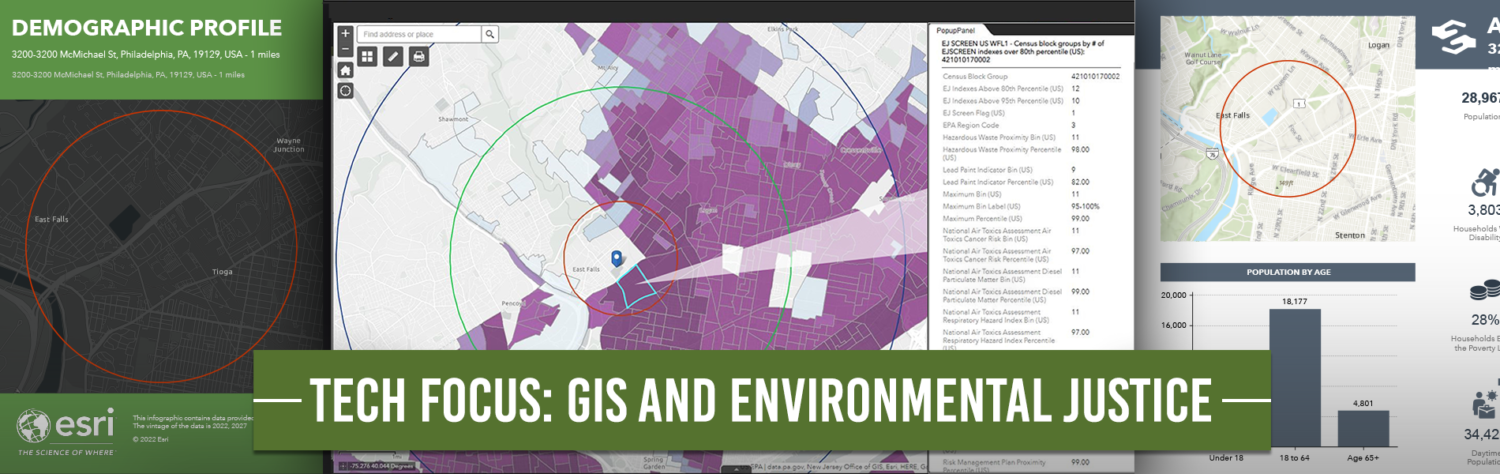
Langan utilizes Geographic Information Systems (GIS), along with Esri’s Business Analyst and data layers sourced from the census and other federal and state agencies, to map and analyze various socioeconomic factors to support community redevelopment throughout the country. Harnessing the power of GIS, Langan can perform analysis by using the following data:
- Demographic profiles, crime summaries, household income, unemployment, etc.
- Proximity to hazardous waste, contamination, superfund sites, underground storage tanks, and wastewater discharge points
- National Air Toxics Assessment Cancer Risk, Diesel Particulate Matter, and Respiratory Hazard Indexes
Finding development opportunities in any area can be difficult, especially when that development will greatly impact the surrounding community. Langan helps navigate these challenges by incorporating data related to environmental justice into a client’s site selection process. The combination of available data with Langan’s integrated expertise helps clients move forward with projects that are beneficial to the local community—even in locations where new development was previously avoided.