University of Miami – GIS Utility Mapping & Website

OVERVIEW
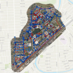
Langan worked with the University of Miami’s Facilities & Operations Department to develop a web-based digital mapping application identifying the locations of all underground utilities on the Coral Gables campus. We converted dozens of paper utility maps—including decades of utility improvements—into a digital format compatible with a GIS system. The data is now easily accessible by authorized UM employees, allowing them to navigate the map and quickly obtain information about each utility.